- Catalogs
- ComNav Technology Ltd.
- LS600 Laser Scanner
- Products
- Catalogs
- News & Trends
- Exhibitions
LS600 Laser Scanner

LS600 Laser Scanner
The LS600 is a state-of-the-art handheld 3D laser scanner that integrates advanced SLAM technology, a built-in RTK module for centimeter-level accuracy, and dual wide-angle cameras for vivid color capture. It is designed for high-speed scanning and detailed color point clouds, suitable for both indoor and outdoor environments.
- Housing Material: Industrial-grade aluminum
- Weight: 2.3 kg
- Power Consumption: <35W
- Storage: 512GB SSD (expandable)
- Wireless: WIFI, Bluetooth
- Software Support: ScanMaster (mobile) / RealEditor (PC)
- Laser Class: Class 1 / 905 nm
- Number of Lines: 16 / 32
- Field of View: 360° × 270°
- Range: 0.5–120 m / 0.5–300 m (4 configurations)
- Scan Rate: 16 lines: 320,000 pts/s, 32 lines: 640,000 pts/s
- Type: Li-ion battery
- Voltage: 14.4 V
- Capacity: 48.24wh
- Typical Operating Time: 1.5 hours
- Operating Temperature: –20°C to +50°C (–4°F to 122°F)
- IP Rating: IP54
- Number of Cameras: 2
- Camera Resolution: 16 MP × 2
- FOV: 190°×190°
- GNSS Support: GPS, BDS, GLONASS, Galileo, QZSS, IRNSS, SBAS
- Accuracy: Absolute Vertical/Horizontal Accuracy (RMSE) 3 cm, Real-time Relative Accuracy (RMSE) 2 cm, Processed Relative Accuracy (RMSE) 1 cm, Repeat Accuracy (RMSE) 2 cm
- Point Cloud Thickness (RMSE): ≤ 0.5 cm
- Horizontal/Vertical Angular Accuracy: ≤0.05°
- Processing Mode: Real-time + Post-processing
- RTK Accuracy: Horizontal 8 mm + 1 ppm (RMS), Vertical 15 mm + 1 ppm (RMS)
- Point Cloud Format: .las
- Image Format: .jpg
- Extended Range & High-Speed Capture: Available in four configurations with scan rates of 320,000 or 640,000 points/sec.
- High Accuracy & Built-in RTK Module: Supports high-precision GNSS solutions for robust performance.
- Dual-Lens Camera & Vivid Color: Equipped with dual 16MP cameras for detailed color point clouds.
- Integrated Professional Surveying Antenna: Ensures robust performance with superior signal acquisition.
- Land Survey: Excellent performance for mapping and data collection.
- Engineering Survey: Precise data for construction site monitoring and progress tracking.
- Urban Renewal: 3D modeling for infrastructure upgrades and city planning.
- Mining Survey: Pit volume calculations and slope stability monitoring.
- Agriculture & Forestry: Crop health analysis and forest resource evaluation.
- Emergency Survey: Disaster area mapping for rapid assessment.
- ComNav RealEditor: A 3D data processing platform with advanced SLAM optimization and editing tools.
- ScanMaster (Android): Offers simple operation, real-time preview, and intelligent management.
Catalog excerpts

I LS600 Laser Scanner GNSS Surveying System Ver.2025.02.20 Multi-Sensor . Fusion Integrates LiDAR, IMU, camera, and GNSS chip for reliable, high-precision performance in challenging environments (low light, narrow spaces, urban canyons, etc.). Type Li-ion battery Typical Operating Time 1.5 hours Versatile Scanning Modes Sfreamlihed Post-Processing WorjflpWc^fe*- Automated stitching, denoising, and rendering ensure efficient production of high-quality point SYSTEM PARAMETERS Housing Material Industrial-grade aluminum Software Support ScanMaster (mobile) / Wireless WIFI, Bluetooth Laser Class Class 1 / 905 nm Scan Rate 16 lines: 320,000 pts/s Absolute Vertical/Horizontal 3 cm Accuracy (RMSE) 2 Real-time Relative Accuracy 2 cm (RMSE) 3 Processed Relative Accuracy 1 cm (RMSE) 3 Repeat Accuracy (RMSE) 4 2 cm Point Cloud Thickness < 0.5 cm Horizontal/Vertical Angular Accuracy 2 Processing Mode RTK Accuracy (Horizontal) RTK Accuracy (Vertical) Point Cloud Format Image Format TurboCloud Enhance Supports UTM, Gauss-Kruger, and other projections for direct, project-ready data output, ensuring seamless integration with GIS/CAD workflows. 1. With handheld battery and GCP collection plate 2. Refers to real-time/processed data. No RTK signal loss more than 100 m 3. The distance between two points is less than 100 m 4. Two scans both with full RTK signal 5. Horizontal thickness of the point cloud within 10 m of the travel path Note: Final delivered specifications may vary slightly based on actual production and development. Laser Scanner I Features Extended Range & High-Speed Capture Offered in four configurations-16-line or 32-line LiDAR, each with 120m or 300m range-the LS600 delivers scan rates of 320,000 points/sec (16-line) or 640,000 points/sec (32-line), significantly boosting field efficiency. High Accuracy & Built-in RTK Module Powered by SinoGNSS’s self-developed GNSS module, the LS600 supports high-precision, full-frequency GNSS solutions-delivering robust centimeter-level performance across diverse satellite constellations. Dual-Lens Camera & Vivid Color Equipped with dual 16MP wide-angle cameras (190° * 2) to capture multi-angle color data. Combined with visual-aided SLAM (V-SLAM), the system generates highly accurate, richly detailed color point clouds-delivering more realistic visualization and deeper insights. Integrated Professional Surveying Antenna UNLOCK NEXT-LEVEL 3D SCANNING Features a built-in, high-precision surveying-grade antenna with superior signal acquisition, ensuring robust performance. LS600 supports connection to a pole for professional SLAM and RTK surveying. Building 2, No. 618 Chengliu Middle Road, 201801 Shanghai, China ©2025, ComNav Technology Ltd. All rights reserved. is the official trade mark of ComNav Technology Ltd., registered in People's Republic of China, EU, USA and Canada. All other trademarks are the property of their respective owners. (February, 2025).
Open the catalog to page 1
The LS600 is a next-generation handheld 3D laser scanner that seamlessly combines advanced SLAM technology, a built-in RTK module for centimeter-level accuracy, and dual wide-angle cameras for vivid color capture. Through multi-sensor fusion (LiDAR, IMU, and camera), the LS600 achieves robust performance in both indoor and outdoor environments—delivering high-speed scanning, richly detailed color point clouds, and streamlined post-processing. Its lightweight, all-in-one design ensures efficiency and reliability across diverse industries, from surveying and urban renewal to mining and emergency...
Open the catalog to page 2All ComNav Technology Ltd. catalogs and technical brochures
 T20 Palm GNSS Receiver
2 Pages
 A100 Series Smart Antenna
2 Pages
 P6H Handheld
2 Pages
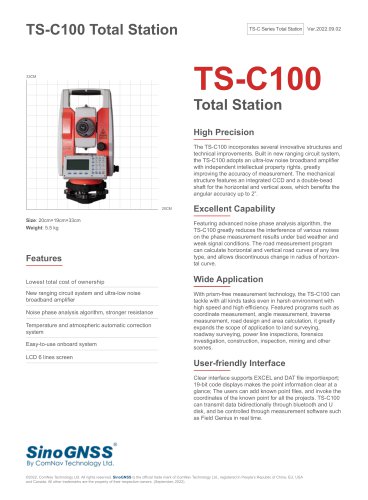 TS-C100 Total Station
2 Pages
 P8 Tablet
2 Pages
 M900 GNSS Receiver
2 Pages
 M300 Pro GNSS Receiver
2 Pages
 T300 GNSS Receiver
2 Pages
 K708 OEM Board
2 Pages
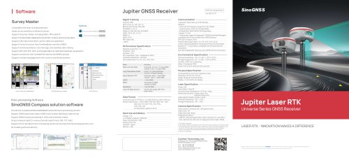 SinoGNSS Jupiter Laser RTK
2 Pages
 Venus Laser RTK
2 Pages
 SinoGNSS Mars Laser RTK
2 Pages
 SinoGNSS Mars Pro Laser RTK
2 Pages
 K700 GNSS Module
2 Pages
 K705 GNSS Module
2 Pages
 K827 GNSS Board
2 Pages
 K825 GNSS Module
2 Pages


Archived catalogs
 GNSS Tablet
2 Pages
 R550 Data Collector
2 Pages
 M600 Mini GNSS Receiver
2 Pages
 K700 OEM Board
2 Pages
 K528G OEM Board
2 Pages
 U30 Datalink Modem
2 Pages
 AT Series GNSS Antenna
2 Pages
 K708 OEM Board
2 Pages

- Agricultural software
- ComNav Technology GNSS receiver
- ComNav Technology data management software
- Guiding system
- Real-time software
- ComNav Technology GPS receiver
- ComNav Technology GLONASS receiver
- Analysis software
- ComNav Technology GALILEO receiver
- ComNav Technology RTK receiver
- Automated auto steering kit
- ComNav Technology precision agriculture software
- On-board computer with screen
- Digital on-board computer
- ComNav Technology precision agriculture receiver
- ComNav Technology farm machinery antenna
- Tractor auto steering kit
- Mapping software
- GNSS auto steering kit
- Agriculture machine auto steering kit