


- Company
- Products
- Catalogs
- News & Trends
- Exhibitions
Hi-Survey
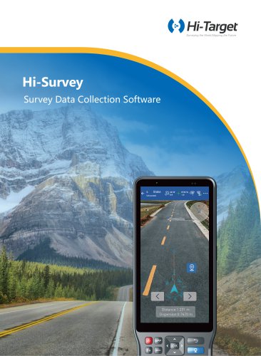
Hi-Survey
- Supports tilt survey, electronic bubble, and time mode static survey.
- Includes professional measurement functions for engineering applications.
- Offers road functions, GIS collection, and DTM surface operations.
- Integrates AR stakeout, QR code scanning, and FTP transmission.
- Supports importing and exporting various file formats including DXF, DWG, and ESRI shapefiles.
- Compatible with multiple coordinate systems and map services like Google Maps and ArcGIS Online.
- Offers advanced CAD data management and DTM surface design.
- Provides tools for area and volume calculation, coordinate conversion, and intersection calculation.
- Operates on Android with options for online activation and offline registration.
- Supports multiple languages including English, French, German, and more.
- Includes features like code table management, auto collection, and AR measurement.
- Integrates GIS feature management and supports online map services like WMS and WMTS.
- Facilitates various stakeout methods including point, line, polygon, and AR stakeout.
Catalog excerpts

Surveying the World[ Mapping the Future Hi-SurveySurvey Data Collection Software Unnamed
Open the catalog to page 1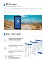
Survey Data Collection Software Hi-Survey is an Android software for all types of land surveying and road engineering projects. It is compatible with Hi-Target professional controllers, Android phones, tablets and other third-party Android devices. As a sleek and easy-to-use software, Hi-Survey supports big data operation with built-in tools and also provides customized industrial application solutions. KEY FEATURES High accuracy and good reliability with various algorithms even in tough environments. Supporting tilt survey, quasi-dynamic technology, electronic bubble, detail survey, time mode...
Open the catalog to page 2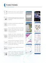
Optimized tilt survey correction algorithm 30° and procedure to boost efficient fieldwork. Android-based high-performance image processing technology, controller real-time acquisition of coordinates. AR stakeout to guide directions with the intelli- gent voice and compass. Users can view the number of the tracking satellites, PDOP, Elevation Mask, the current satellite constellations and other information in the sky plot interface. Integrates GIS feature management, data collection and editing, import and export, and supports WMS, WMTS, WFS and WFTS online map services. Advanced CAD data management,...
Open the catalog to page 3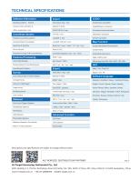
Bulgarian, Simplified Chinese, Traditional Chinese, English, French, German, Greek, Icelandic, Iranian Persian, Italian, Japanese, Korean, Lithuanian, Magyar, Mongolian, Polish, Portuguese, Romanian, Russian, Serbian, Spanish, Thai, Turkish, Vietnamese. Point/ Line/ Polygon Stakeout Road&Slope Stakeout Cross-section Data (*.DMX, *.hdm, *.DMG, *.HDX, *.BGHN, *.dmx) Report (*.html) Advanced Function Photovoltaic Stakeout Reference Drection: Sun Azimuth, North or Forward direction Road Design Descriptions and specifications are subject to change without notice. AUTHORIZED DISTRIBUTION PARTNER Hi-Target...
Open the catalog to page 4All Hi-Target catalogs and technical brochures


Archived catalogs
 V200
2 Pages
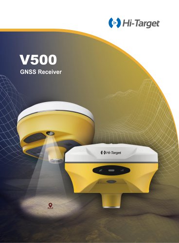
 V500 GNSS Receiver
2 Pages
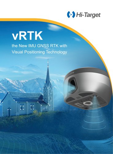
 vRTK
4 Pages
- Agriculture software
- GNSS receiver
- On-board multi-purpose instrument
- Data management software
- GPS receiver
- GLONASS receiver
- Guiding system
- GALILEO receiver
- Analysis software
- RTK receiver
- Digital multi-purpose instrument
- Multi-purpose instrument with screen
- Automated auto steering kit
- Precision agriculture receiver
- Precision agriculture software
- Crop input controller
- Mapping software
- On-board crop input controller
- Agriculture machine auto steering kit
- Tractor auto steering kit