


- Company
- Products
- Catalogs
- News & Trends
- Exhibitions
V200
V200
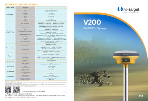
The Hi-Target V200 GNSS RTK System is a high-precision surveying instrument designed for fieldwork efficiency and reliability. It features advanced RTK technology and a new-generation IMU for improved performance in challenging environments.
Technical Specifications
- GNSS Signal Support: Supports multiple satellite systems including GPS, BDS, GLONASS, Galileo, QZSS, NavIC, and SBAS.
- Positioning Performance: Offers high-precision static and real-time kinematic (RTK) positioning with various initialization times and reliability metrics.
- Communication: Equipped with internal UHF radio, Wi-Fi, and Bluetooth for versatile connectivity. Supports multiple communication protocols.
- Physical Specifications: IP68 rated for water and dust resistance, designed to withstand a 2m fall onto concrete, and operates in extreme temperatures.
- Power and Battery: Features a rechargeable lithium-ion battery with up to 24 hours of operation.
Key Features
- Portability: Lightweight design with a durable EPP material case and a compact centering rod.
- Accuracy and Precision: High-performance patch antenna for enhanced satellite tracking.
- Flexibility: Built-in IMU and core algorithm for reliable results and efficient fieldwork.
- Stability: Hi-Fix technology ensures continuous connectivity even in signal loss scenarios.
Additional Capabilities
- Advanced CAD data management supporting DXF and DWG formats.
- Web UI and NFC compatibility for ease of use with third-party software.
- Optimized tilt survey with quick initialization and long-term precision maintenance.
Conclusion
The Hi-Target V200 GNSS RTK System is a robust and versatile tool for surveying professionals, offering high accuracy, flexibility, and stability in various field conditions.
Catalog excerpts

TECHNICAL SPECIFICATIONS GNSS Feature GNSS Signal① Specification Channels PPP High-precision static GNSS Surveying Positioning rate Cold start:< 45 s Time to first Fix Hi-Fix③ Code Differential GNSS Positioning Real Time Kinematic (RTK) Initialization time:Typically 10 min for base and 5 min for rover Post Processing Kinematic (PPK / Stop & Go) Static and Fast Static Tilt Survey Performance④ Additional horizontal pole-tilt uncertainty typically less than 8 mm +0.7 mm / °tilt (0° ~ 60°) Bluetooth:BT 5.2, 2.4GHz Wi-Fi:frequency 2.4GHz, Supports 802.11 b/g/n Frequency:410-470MHz Communication Internal UHF Radio Internal battery⑤ Signal re-acquisition:< 2 s Vertical:RTK+20mm / minute RMS Transmitting power:0.5W / 1W / 2W adjustable Supports multi-communication protocols:HI-TARGET, TRIMTALK450S, TRIMMARK III, TRANSEOT, SATEL-3AS, etc. Internal 7.2V / 6900mAh lithium-ion rechargeable battery RTK Rover (UHF/Cellular): up to 24 hours* Charging:using standard smartphone chargers or external power banks. External power Data storage:16GB ROM internal storage Control Panel Data Formats Satellite, Signal, Power LED Lamp Physical button Water / Dustproof Free fall Designed to survive a 2m natural fall onto concrete Operation temperature Storage temperature 1 × USB port, Type C 1 × SMA antenna connector Output rate Static data format Network model VRS, FKP, MAC; supports NTRIP protocol Real Time Kinematic (RTK) Navigation outputs ASCII *Description and Specifications are subject to change without notice. 1.QZSS L6 can be provided by firmware upgrade. 2.The measurement accuracy, precision, reliability and initialization time depend on various factors, including tilt angle, number of satellites, geometric distribution, observation time, atmospheric conditions and multi-path validation, etc. The data are derived under normal conditions. 3.Accuracies are dependent on GNSS satellite availability. Hi-Fix Positioning ends after 5 minutes without differential data.Hi-Fix is not available in all regions, check with your local sales representative for more information. 4.Irregular operations such as rapid rotation and high-intensity vibration may affect the inertial navigation accuracy. 5.The battery operating time is related to the operating environment, operating temperature and battery life. AUTHORIZED DISTRIBUTION PARTNER Hi-Target Surveying Instrument Co. Ltd ADD: Building 13, Tian'An Technology Zone HQ Center, No. 555, North of Panyu RD, Panyu District, 511400 Guangzhou, China. www.hi-target.com.cn +86-20-28688296 i
Open the catalog to page 1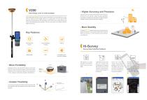
Higher Accuracy and Precision Good things come in small packages V200 GNSS RTK Receiver brings superior performance and high efficiency to support your fieldwork with reliable solutions. Its deployment of the advanced RTK engine and new-generation IMU guarantees a 25% performance improvement even in the most demanding environments. Thus you can count on Hi-Target V200 for better productivity. Equipped with the High-Performance Patch Antenna, enhances the low elevation angle tracking capabilities and keeps it maintaining a high gain for higher elevation satellites while tracking low-elevation...
Open the catalog to page 2All Hi-Target catalogs and technical brochures


Archived catalogs
 V200
2 Pages
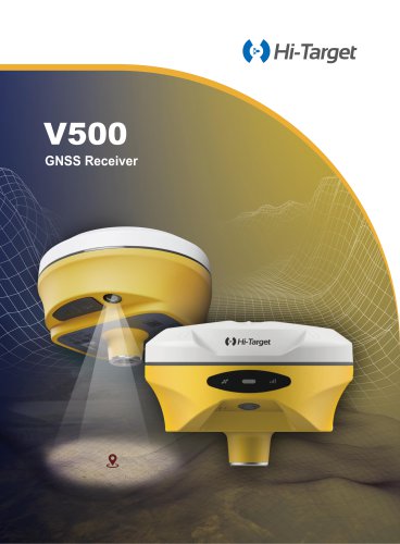
 V500 GNSS Receiver
2 Pages
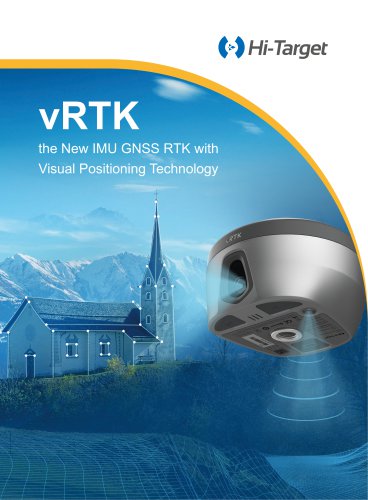
 vRTK
4 Pages
- Agriculture software
- GNSS receiver
- On-board multi-purpose instrument
- Data management software
- GPS receiver
- GLONASS receiver
- Guiding system
- GALILEO receiver
- Analysis software
- Digital multi-purpose instrument
- Multi-purpose instrument with screen
- Automated auto steering kit
- Precision agriculture receiver
- Precision agriculture software
- Crop input controller
- Mapping software
- On-board crop input controller
- Agriculture machine auto steering kit
- Tractor auto steering kit