- Catalogs
- Shanghai eSurvey GNSS Co., Ltd.
- Product Catalog
Product Catalog
1 /50Pages

Product Catalog
1 /50Pages
Catalog excerpts

Floor 4, Building 3, No. 559, Zhuyuan Rd, Minhang District, Shanghai, China esurvey-gnss.com | +86 400-999-8088 (Select 3) Shanghai eSurvey GNSS Co., Ltd. PRODUCTCATALOG Website & Social media esurvey-gnss.com
Open the catalog to page 1
About eSurvey A UniStrong company, established in 2005, eSurvey started global business in 2018 with its nearly 20 years of R&D and production experience in the field of the geospatial industry. Our commitment is to deliver high-precision GNSS navigation and positioning solutions, as well as advanced 3D mapping, all supported by stable performance and continuous innovation. eSurvey empowers professionals across various sectors, including infrastructure construction, geographic information, precision agriculture, and marine surveying, to achieve unprecedented accuracy and operational efficiency....
Open the catalog to page 3
Integrated GNSS Systems Powered by self-developed IMU algorithms, high-performance GNSS chips, boards, radio modules, and an integrated antenna as a solid technological foundation, eSurvey GNSS receivers provide great precision and efficiency.
Open the catalog to page 5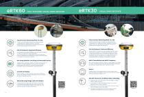
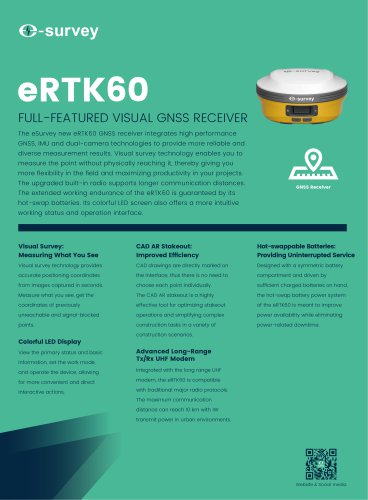
FULL-FEATURED VISUAL GNSS RECEIVER The eSurvey eRTK60 GNSS receiver integrates high performance GNSS, IMU and dual-camera technologies to provide more reliable and diverse measurement results. Visual survey technology enables you to measure the point without physically reaching it, thereby giving you more flexibility in the field and maximizing productivity in your projects. The upgraded built-in radio supports longer communication distances. The extended working endurance of the eRTK60 is guaranteed by its hot-swap batteries. Its colorful LED screen also offers a more intuitive working status...
Open the catalog to page 6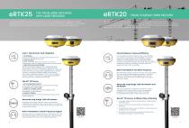
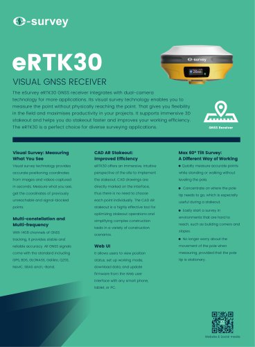
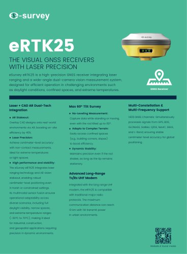
THE VISUAL GNSS RECEIVERS WITH LASER PRECISION The eSurvey eRTK25 is a high-precision GNSS receiver integrating laser ranging and a wideangle dual-camera vision measurement system, designed for efficient operation in challenging environments such as daylight conditions, confined spaces, and extreme temperatures. VISUAL STAKEOUT GNSS RECEIVER The eSurvey eRTK20 GNSS receiver combines GNSS, IMU, wide-angle dual cameras, and a compact design to dramatically improve surveying efficiency. The CAD AR visual stakeout can increase project stakeout efficiency by 40%. With inbuilt radio (Tx and Rx) and...
Open the catalog to page 7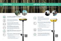
FULL-FEATURED GNSS RECEIVER The eSurvey E300 Pro is a fully functional GNSS receiver with an extremely compact design by eSurvey. With its high-performance GNSS board, it can track all present constellations and satellites. The GNSS, Wi-Fi, Bluetooth, and GSM four-in-one antenna, stable data transmission, RTK Aid and IMU function, make it suitable for all surveying applications. It integrates IMU tilt technology for efficient stakeout. It features a compact and lightweight design for easy portability and also serves as an ideal high-precision GNSS positioning sensor that seamlessly integrates...
Open the catalog to page 8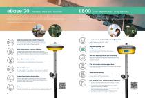
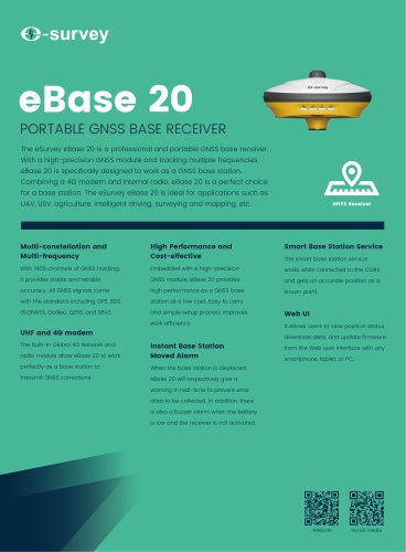
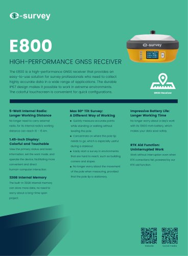
PORTABLE GNSS BASE RECEIVER The eSurvey eBase 20 is a professional and portable GNSS base receiver. With a high-precision GNSS module and tracking multiple frequencies, eBase 20 is specifically designed to work as a GNSS base station. Combining a 4G modem and internal radio, eBase 20 is a perfect choice for a base station. The eSurvey eBase 20 is ideal for applications such as UAV, USV, agriculture, intelligent driving, surveying and mapping, etc. The E800 is a high-performance GNSS receiver that provides user-friendly solution that empowers survey professionals to capture highly accurate data...
Open the catalog to page 9
In the global surveying industry's era of digital transformation, digital tools have become the new standard. We specialize in the development of high-precision, reliable, and highly efficient portable LiDAR systems designed to fully support modern surveying workflows. Utilizing advanced algorithms, our mobile scanners capture real-time 3D point clouds directly on-site, providing a true “what you see is what you get" experience. Serving as a vital link between the physical and digital worlds, our equipment enables data-driven decisions and accelerates innovation. Applications of Three-Dimensional...
Open the catalog to page 10
RELIABLE SCANNER FOR EVERY APPLICATION The eScan M1 is an mobile 3D laser scanner, integrating point cloud scanning, panoramic image capture, and detailed visual recording into a single compact system. Its highperformance algorithm allows for real-time collection and processing of 3D data, significantly improving on-site operating efficiency. Terrain mapping, mining, public safety, underground space surveying, forestry, oil and gas pipelines, construction workflows, education, and the film industry are all common applications. HIGH-PRECISION AIRBORNE LIDAR SOLUTION The eLidar A1 LiDAR system...
Open the catalog to page 11
SMART SCANNING STARTS HERE From as-built surveys in smart construction and digital twins for intelligent manufacturer to historical conservation, tunnel inspection, ship retrofits, wall thickness gauges of steel ladle, and even public-safety applications, the eScan T3 is the scanner you can trust. This mid-range pulsed terrestrial laser scanner delivers 1.5 mm accuracy in practically any application. Its ultra-compact 4kg chassis—among the lightest in its class— captures up to 1 million points per second, allowing you to complete a full-station scan very quickly, thus increasing your field productivity....
Open the catalog to page 12
eSurvey optical products are designed to simplify the field workflow, improve measurement accuracy and reduce the workload of surveyors. Featuring precise mechanical architecture, excellent optoelectronic design, and rich measurement applications in land surveying, urban surveying, construction, and deformation monitoring, eSurvey optical products are the perfect choices for you.
Open the catalog to page 13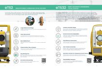
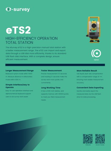
HIGH EFFICIENCY OPERATION TOTAL STATION The eSurvey eTS2 is a high-precision manual total station, with longer measurement range. With standard USB flash disk interface, it can import and export data through USB disk more conveniently.A more concise design enables highly efficient measurement. Capable of measuring distances up to 5,000 m with a prism and 1,000 m in reflectorless mode. With a modern, streamlined exterior, the eTS32 features an optimized keyboard layout for intuitive operation, reducing bulk and enhancing field usability compared to traditional total stations. Extreme Environment...
Open the catalog to page 14All Shanghai eSurvey GNSS Co., Ltd. catalogs and technical brochures
 P9IV
P9IV2 Pages
 eBase 20
2 Pages
 E600
E6002 Pages
 E500
E5002 Pages
 P8III
P8III2 Pages
 EAS301 Pro Hydraulic
4 Pages
 eTS32
eTS322 Pages
 E3
E32 Pages
 eTS2
eTS22 Pages
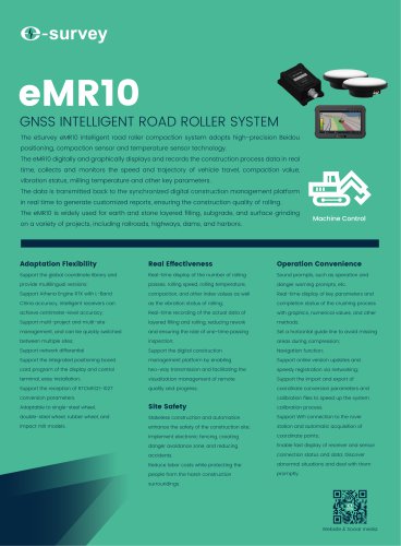 eMR10
eMR104 Pages
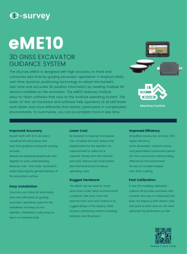 eME10
eME104 Pages
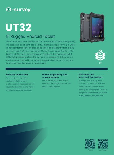 UT32
UT322 Pages
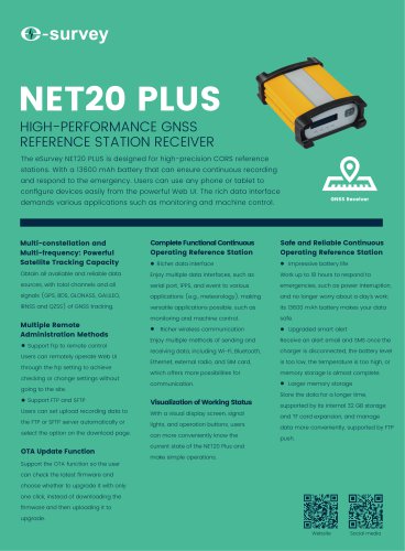 NET20 PLUS
2 Pages
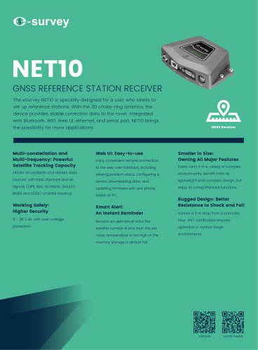 NET10
NET102 Pages
 eDMR1
eDMR12 Pages
 E800
E8002 Pages
 E300 Pro
2 Pages
 eRTK60
2 Pages
 eRTK30
2 Pages
 EAS301 Pro Motor
4 Pages
 eRTK10 mini
2 Pages
 eRTK25
2 Pages
 EAS502
2 Pages
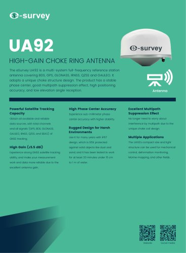 UA92
UA922 Pages
- Agricultural software
- Digital control system
- Data management software
- GPS receiver
- GLONASS receiver
- Guiding system
- GALILEO receiver
- RTK receiver
- Analysis software
- Automated auto steering kit
- Precision agriculture receiver
- Precision agriculture software
- Farm machinery antenna
- Mapping software
- Tractor auto steering kit
- Wireless receiver
- GNSS auto steering kit
- Agriculture machine auto steering kit
- GNSS antenna