MAGNET

MAGNET
The MAGNET Software Suite is designed to enhance the construction industry's efficiency by providing accurate and compatible project data, minimizing rework, and improving collaboration. It integrates field, cloud, and office software with Topcon's instruments and machine control, ensuring data accessibility and accuracy across all project stages.
Comprehensive Coverage
MAGNET supports a wide range of construction activities such as earthmoving, paving, stakeout, surveying, and building construction. It enhances productivity by creating machine-ready models, optimizing mass-haul operations, and simplifying layout and verification processes.
Connected and Compatible
The software facilitates seamless collaboration between field and office with up-to-date plans, supporting over 50 industry-standard drawing formats for easy integration of third-party data.
In the Field
MAGNET Field software boosts productivity and accuracy for surveyors and contractors, supporting data management, 3D layout creation, and hybrid GNSS and total stations control. It also offers professional quality reporting and integration with smart glasses for hands-free operation.
In the Cloud
MAGNET Enterprise enables efficient management of geopositioning data, offering real-time collaboration and cloud-based data management. It integrates with Autodesk and Bentley solutions for enhanced data accessibility.
In the Office
MAGNET Office optimizes digital infrastructure workflows, including machine-control models and project scheduling, supporting the creation of constructible digital terrain models and mass-haul project management.
Getting Started
Users can access trials for MAGNET Field and Office products through demonstration mode or a 30-day trial license, available as a subscription or permanent license.
MAGNET Office Configurations
MAGNET Office offers several configurations tailored to specific tasks, including 3D Exchange, Layout, Survey, Site, Construction, and Project, each providing specialized tools for different construction needs.
Functionality and Connectivity
The document highlights functionalities such as field-to-office connectivity, GNSS and total stations processing, machine control data conversion, layout point creation, and advanced design capabilities.
MAGNET Field Software Offering
MAGNET Field software supports data collection on Windows 10, Android, and iOS, with modules for various surveying and construction tasks.
MAGNET Enterprise Offering
MAGNET Enterprise provides cloud-based data storage, facilitating connectivity between field and office teams, included with any MAGNET subscription or permanent licenses.
Support
Topcon offers extensive support through myTopcon, including training and support content, quick guides, training videos, webinars, and e-learning resources.
Disclaimer
Specifications are subject to change without notice. All rights reserved by Topcon Positioning Systems, Inc.
Catalog excerpts

MAGNET Your Work Connected
Open the catalog to page 1
MAGNET Software Suite: Field, Cloud and Office MAGNET Field for Increased Accuracy and Efficiency MAGNET Enterprise for Efficiently Managing Geopositioning Data Getting Started MAGNET Office for Productive and Profitable Workflows How to choose your configuration and get started
Open the catalog to page 2
MAGNET Software Suite Field, Enterprise and Office The construction industry is looking for new solutions to cut down on the billions of dollars lost each year due to inaccurate and incompatible project data leading to rework and collaboration breakdowns. The MAGNET software suite addresses this need by streamlining workflows for contractors, surveyors, modelers, estimators and project managers across each stage of a construction project. This field, cloud and office software suite, when combined with Topcon’s state-of-theart instruments and machine control, enable users to create and access...
Open the catalog to page 3
A key component of Topcon’s digital ecosystem. Planning | Survey | Design | Layout | Execution | Inspection | Maintenance
Open the catalog to page 4
Comprehensive MAGNET provides full application coverage with end-to-end workflows for contractors and surveyors. This software suite improves productivity across the entire project: Earthmoving and paving Improve earthmoving and paving machine-control efficiency by quickly creating machine-ready constructible models and estimates to win more projects and save on materials. MAGNET maximizes your data and resources from earthworks to concrete, asphalt paving and resurfacing applications. Stakeout and surveying Create highly productive workflows for stakeout as well as for gathering survey and construction-location...
Open the catalog to page 5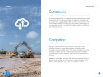
Connected A connected approach to your projects includes seamless field-to-office collaboration with one set of plans that are always up to date across the project team. Integrated field, office, machine, instrument and thirdparty software keeps your project team connected so that they are on the same page working more efficiently together towards a productive and profitable outcome. Compatible Seamless integration eliminates boundaries, data silos and the limitations inherent in mixed-fleet situations, providing a totally compatible solution that just works. This makes it possible to combine...
Open the catalog to page 6
MAGNET Field for Increased Accuracy and Efficiency
Open the catalog to page 7
The engine to field productivity MAGNET Field, the engine for our field-productivity package, is designed to accelerate productivity, increase accuracy and better connect project teams. The intuitive software is easy to learn and use and yet has the power to solve even the most complex positioning challenges. Surveyors and contractors alike use MAGNET Field to collect data points, stake out road and site projects, lay out building components and perform land surveys. Running MAGNET Field on a ruggedized Topcon controller brings field-proof high-computing capabilities directly to your jobsite....
Open the catalog to page 8
MAGNET Field Highlighted Features Data handling Users can navigate to more points per day and easily lay them out with straightforward commands for streamlined and dependable workflows. Whether starting fresh or switching from another software platform, you will have a smooth transition to MAGNET Field. Create 3D layouts with a BIM interface that enables multiple floor views including filtering by level using the popular IFC file format. Create objectinsertion points to lay out 3D objects directly in the field software. Display project data faster and handle larger and more complex jobsite files...
Open the catalog to page 9
MAGNET Field Highlighted Features Professional field-based, quality reporting Create professional reports and annotated photographs directly from the field to immediately share positioning accuracy, tolerances and observations. Improve documentation to reduce the high cost of rework caused by undiscovered inaccuracies, poor data and miscommunication. Map-based workflows Avoid lost time switching between screens thanks to flexible workflow options controlled directly from the map view. Workflow options include staking project data, adjusting layer settings, displaying backgrounds, adding data...
Open the catalog to page 10
MAGNET Field Layout This data-collection software is designed specifically for quick and accurate layout and construction verification. With in-the-field plan and dimensional entries, you can move from paper plan or 3D model to building layout faster than ever. MAGNET Field Layout also includes scanning capabilities for use with construction-verification workflows.
Open the catalog to page 11
MAGNET Vision See visual aids on smart glass lenses and control instruments via voice commands. This software enables users to precisely lay out and measure points on a job site, increasing productivity and worker safety with hands-free operation. The system is an add-on to MAGNET Construct field-controller software and utilizes third-party Vizux Blade smart glasses.
Open the catalog to page 12
MAGNET Enterprise for Efficiently Managing Geopositioning Data
Open the catalog to page 13
MAGNET Enterprise Store data and insights for access by field crews, machine operators and office team members using MAGNET software, Sitelink3D, Autodesk or Bentley solutions. This web service provides seamless field-to-office connectivity for your projects, making a real-time connected data environment possible. Project data is saved to the map, and files can be instantly converted and shared with a field controller or machine. MAGNET Enterprise improves productivity as downtime and do-overs are minimized by providing the entire project team with increased accessibility to accurate and consistent...
Open the catalog to page 14
MAGNET Enterprise Highlighted Features All your projects on a web-interface map Cloud-based data management Connect the digital and the real worlds with a visual map of your project datasets directly georeferenced to the earth with background maps. Keep the entire project team working on the latest plans, and benefit from singleclick data conversion to share survey and constructible models directly to instruments and machines on site. Real-time collaboration Annotate or redline the map or plans in the cloud browser to directly transfer instructions or notes to keep your field crew working at...
Open the catalog to page 15All Topcon Precision Agriculture catalogs and technical brochures
 Landforming
2 Pages
 On-Board Weighing TT Weigh
2 Pages
 Digital Farm Management
1 Page
 TAP Satellite Imagery Add-on
4 Pages
 CROPSPEC
2 Pages
 TOPCON WORKPLACE
13 Pages
 APOLLO
4 Pages
 MR-2
MR-21 Page
 HORIZON OS
2 Pages
 X35
X352 Pages
 X25 Console Brochure
2 Pages
 X14 Console Brochure
2 Pages
 X Consoles Brochure
4 Pages
 TopNET live Brochure
2 Pages
 CROPSPEC Brochure
2 Pages


- Nardi Pegaso agricultural software
- Joystick
- On-board multi-purpose instrument
- GNSS receiver
- Tractor multi-purpose instrument
- Digital control system
- Data management software
- Weighing system
- Digital weight indicator
- Analysis software
- Multi-purpose instrument with screen
- Animal husbandry software
- RTK receiver
- Digital multi-purpose instrument
- Crop input control system
- Hand operated joystick
- Spraying control system
- Precision agriculture receiver
- Seeding control system
- Mapping software